

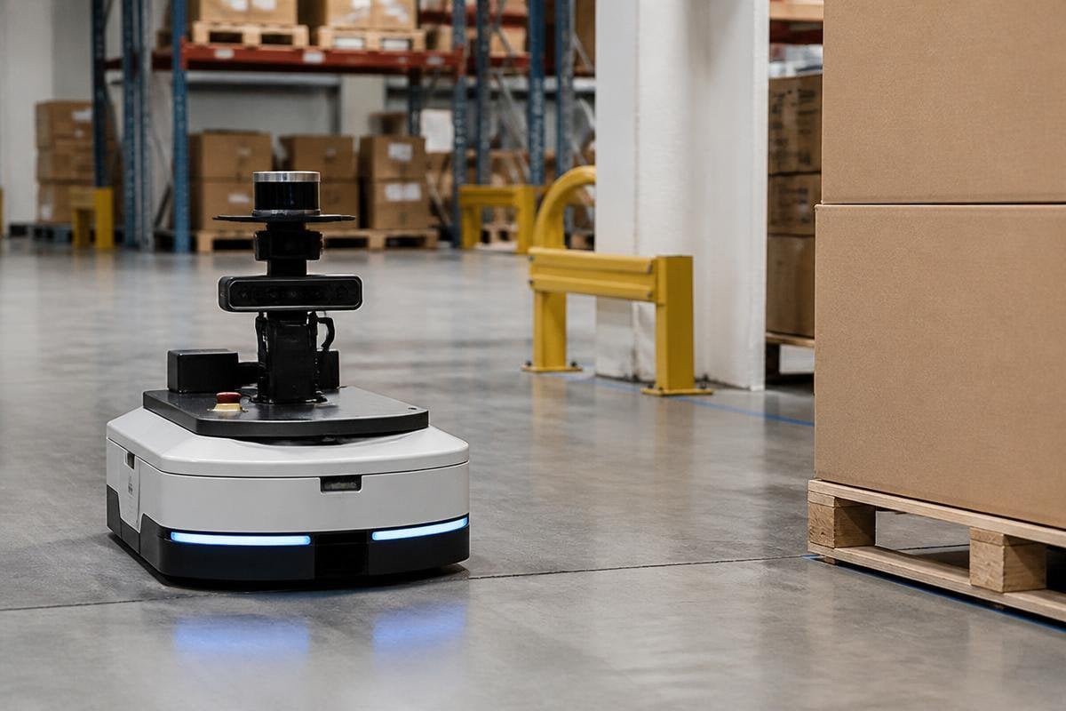
A camera can see a box, but it may struggle to judge its distance. LiDAR can measure that distance, while an inertial measurement unit tracks how the robot is moving. Sensor fusion brings those separate readings into one working view for navigation.
- Cameras add color and object detail
- LiDAR measures distance and shape
- Motion sensors track speed, tilt, and turns
One robot, several views
A robot moves through places where no single sensor gives enough information. A camera records images, LiDAR sends out light pulses to measure nearby surfaces, and wheel encoders report how far the wheels have turned.
Each sensor sees a different part of the task. The camera can help identify a person or a sign. LiDAR can show that a wall is 2 m away. Wheel encoders can estimate movement, but their reading drifts when a wheel slips on a smooth floor.
That drift matters because navigation depends on knowing the robot’s position. A small error in one turn can become a larger error after many turns, especially inside a warehouse or factory where the robot has no clear view of the sky.
How sensor fusion works
The robot first collects readings with timestamps. Its software then matches those readings by time and location, checks how much each sensor can be trusted, and produces an estimate of the robot’s position.
An algorithm called a Kalman filter is one common way to do this. It predicts where the robot should be after its last movement, then adjusts that estimate when a new sensor reading arrives.
If wheel data says the robot moved 1 m but LiDAR sees the same wall at nearly the same distance, the software can reduce the motion estimate’s error. Other systems use cameras to track visual features, such as corners or floor markings.
This process is called visual odometry. It estimates movement by comparing features across images, much like checking how far a fixed point shifts from one frame to the next.
The result is called localization: an estimate of where the robot is. Mapping adds the surrounding walls, shelves, doors, and other fixed objects so the robot can plan its route through the area.
What happens when a sensor fails
Sensor fusion does not make bad data disappear. It gives the robot more than one way to check its position, but the software still needs rules for faulty readings.
In darkness or glare, the camera may lose useful detail. LiDAR can return confusing readings from glass, reflective metal, or thin objects. An inertial measurement unit can drift over time, and wheel encoders can mislead the robot during a skid.
The robot may compare a new reading with its recent motion. If one sensor reports a sudden jump that the others do not support, the software can reject or reduce that reading. The exact response depends on the sensor setup, the software, and the place where the robot works.
This is why a sensor list tells you less than the full navigation system. A machine with cameras and LiDAR still needs careful calibration, time matching, and tests in the lighting and floor conditions it will face.
Why this matters in a working site
For a warehouse robot, better position estimates can reduce wrong turns and help it keep a safe gap from shelves and people. For a delivery robot, the same process can help it combine camera views with LiDAR measurements when paths, curbs, and obstacles change around it.
Sensor choices follow the robot’s job. A fixed arm may need joint-position and force readings, while an outdoor mobile robot may combine an inertial measurement unit (IMU), wheel encoders, cameras, LiDAR, and satellite positioning. Reports from Robot 24 put those choices beside the tasks and sites where the robots run, giving the next cost question something concrete to measure.
Sensor fusion also affects cost and maintenance. More sensors add hardware, wiring, power use, calibration work, and more data for the computer to process. A low-cost robot may use cameras and wheel encoders, while a machine working near moving vehicles may need extra distance sensing and safety checks.
A practical check before deployment
Use this list when you assess a robot’s navigation system:
- Name the job: write down the floors, lighting, obstacles, speed, and route length.
- Check sensor limits: ask how glass, dust, rain, darkness, glare, and wheel slip affect each sensor.
- Ask about timing: find out how the system matches readings from different sensors.
- Review recovery: see what the robot does after a blocked view, lost signal, or bad position estimate.
- Test the full route: run the robot during normal work, not only in an empty test area.
The right question is not how many sensors a robot carries. Ask what each sensor measures, how the software checks those readings, and what the robot does when one source becomes unreliable. That answer tells you far more than a camera or LiDAR label on a product sheet.
